Officials Monitoring Path of Hurricane Isaias
Details of track uncertain at this time, but Isaias is expected to remain a hurricane for the next few days
[Updated: Aug. 3, 2020: 5:30 p.m.]
Tropical Storm Isaias is expected to make landfall near the North Carolina/South Carolina border and move northeast across eastern portions of the Carolinas Monday night through early Tuesday.
The greatest threats in central North Carolina will be potential flooding and strong wind gust. Due to saturated soils and strong winds, expect numerous downed trees and power lines. Isolated tornadoes are also possible. Conditions should begin to improve south to north late Tuesday morning and into the afternoon.
Officials are in close contact with the Duke Marine Lab in Beaufort, N.C., which could see significantly more rain and stronger winds.
Duke community members are encouraged to report flooding or property damage immediately to the appropriate maintenance unit: Facilities for the university campus, and Engineering & Operations for Duke Hospital and the School of Medicine.
During the storm, individuals are asked to remain indoors to avoid falling trees and limbs or downed electrical lines. Any potential safety-related issues, such as downed trees or power lines, should be reported to the Duke University Police Department, 919-684-2444. Unless a situation is life threatening, crews may wait until after dangerous winds have subsided before responding.
Additional updates and information about Duke’s response to the hurricane will be posted on this page as necessary. Follow Working@Duke on Twitter for updates as well.
[Updated: Aug. 2, 2020: Noon]
The National Weather Service has issued a tropical storm watch for Wake County, which could receive up to 3-6 inches of rain and sustained winds of 25-35 mph with gusts to 50 mph late Monday and Tuesday with landfall of Hurricane Isaias.
Durham County is not currently under a tropical storm watch, but remains under a flood watch due to expected heavy rain the next couple days.
Due to saturated soils and strong winds, expect numerous downed trees and power-lines. Isolated tornadoes will also be possible. Conditions should begin to improve south to north late Tuesday morning into Tuesday afternoon.
[Updated: Aug. 1, 2020: 9:30 a.m.]
Current forecasts indicate that Hurricane Isaias will be a Category 1 Hurricane when it hits the Central Bahamas Saturday morning. The storm currently has maximum sustained winds of 85 mph. Models suggest the potential for tropical storm conditions along the coast as early as Monday with the storm expected to make landfall in the Carolinas early Tuesday morning with winds upwards of 70 mph.
On Friday, N.C. Governor Roy Cooper issued a state of emergency in preparation for the storm. Mandatory evacuations have been issued for several North Carolina beaches, including Ocracoke, Holden Beach and Ocean Isle Beach. Hurricane watches could be issued for North Carolina on Saturday.
Duke officials are working closely with administrators from the Duke Marine Lab, which is located on Pivers Island in Beaufort, N.C., to prepare for approaching storm.
The impact to central North Carolina is expected to modest with between 1 to 3 inches of rain with wind gusts potentially reaching 20 to 40 miles per hour.
[Original Post: Friday, July 31, 2020]
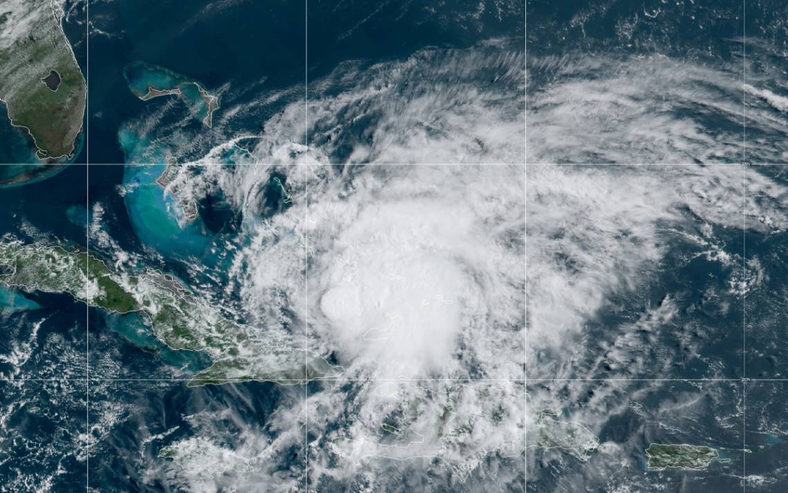
Duke officials are closely monitoring the progress of Hurricane Isaias, which is expected to bring hurricane connditions over portions of the Bahamas today and could threaten southeast coast of the United States, including the Carolina coast, in the days to come.
Kyle Cavanaugh, Duke's emergency coordinator and vice president for administration, said that the Emergency Management Team is already in close contact with officials from the Duke Marine Lab, located on Pivers Island in Beaufort, N.C.
According to the National Hurricane Center, details of the track and intensity remain uncertain, but the center of Isaias will move near or over the southeastern Bahamas today. Isaias is forecast to be near the central Bahamas tonight, and move near or over the Northwestern Bahamas and be near or east of the Florida peninsula on Saturday and Sunday. 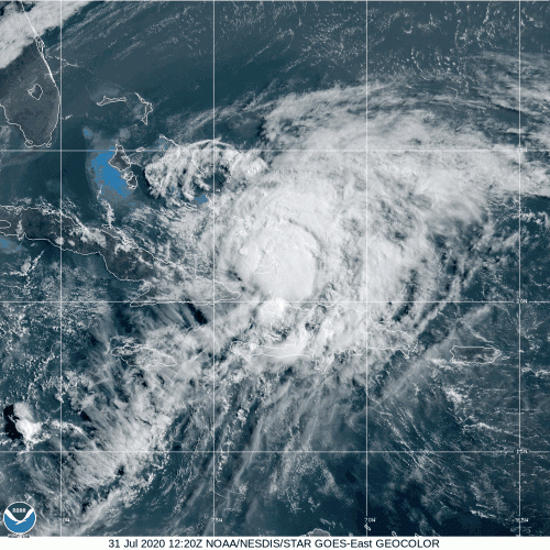
Maximum sustained winds are near 80 mph with higher gusts. Some strengthening is possible today, and Isaias is expected to remain a hurricane for the next few days.
Officials will continue to monitor the storm and provide updates as necessary.
Updates will also be provided as conditions warrant on the Working@Duke Twitter page.